Tuesday, November 13, 2012

Honshu's Climate and Weather Phenomena

Much of Honshu lies among the Midlatitude zone, yet bordering close to the Subtropic zone (roughly around 35 Degrees North Latitude to 23.5 Degrees North Latitude). Because it is so close to both climate zones, Honshu has a huge disparity in climate..

Honshu circled in red (IS 1)
According to the Koeppen Scale, the southern tip of Honshu can be classified as a "C" climate (Mild Midlatitude). The northern portion falls under the "D" category (Midlatitude Climate) (1). Further classification with the Koeppen Scale defines defines the south as a Cfa-a wet humid subtropical, the north as a Dfa-humid continental with hot summers. Both of these climate classifications are marked by hot summers and no dry season. Northern Honshu typically experiences severe, snowy winters (1). 

Classification of Honshu's varying climates (IS 2)
When summer approaches, a mass of cold air begins to form off the north coast of Japan, while over the Pacific Ocean, a warm air mass forms. These two air masses begin to converge over Central Japan. The low pressure cold air pushes the warm air up, causing a low pressure, warm air storm the Japanese call the baiu zensen, or "rainy season front" (2). 

Depicting the basics of the rainy season (IS 3)
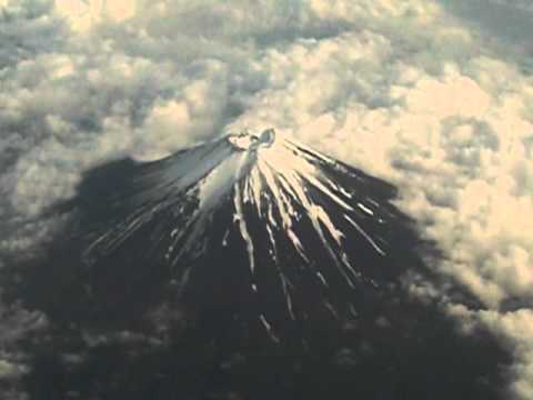
The rainy season ends by the end of July, but the typhoon season begins at the end of summer into September, depending on conditions. Much like hurricanes, typhoons "...originate from large masses of tropical low pressure air in the North Pacific..."(3) They start out as tropical thunderstorms over the Pacific Ocean. These storms then come together and begin to extract heat from the warm Pacific waters (see picture 3). This heat causes evaporation and forces the warm air to be drawn to the center (or eye) of the storm in a cyclonic pattern. It soon seeks out more warm waters to continue powering it (4). 
Typhoon nearing Japan 8/26/2012 (Honshu located in 1st and 2nd grid rows to the right) (IS 4)
About 4 out 30 typhoons make landfall with Japan, bringing heavy rain and destruction. 


Image Sources
IS 1. http://clasfaculty.ucdenver.edu/callen/1202/Climate/EarthTempClim/climatezones.jpg (Editing by Evan Ramirez)
IS 2. http://clasfaculty.ucdenver.edu/callen/1202/Climate/EarthTempClim/img083.gif (Editing by Evan Ramirez)
IS 3. http://home.comcast.net/~rhaberlin/pwpptnts.htm
IS 4. http://www.accuweather.com/en/weather-news/watching-typhoon-pair-near-tai/70871

Sources
1. http://clasfaculty.ucdenver.edu/callen/1202/Climate/EarthTempClim/KoeppenGeneral.jpg
2. http://www.jnto.go.jp/eng/arrange/essential/climate.html
3. http://web-japan.org/factsheet/en/pdf/e01_geography.pdf
4. http://clasfaculty.ucdenver.edu/callen/1202/Climate/Cyclones/FrontsCyclones.html


Thursday, October 11, 2012

Honshu's Rivers

Due to the steep, mountainous topography of much of Honshu, many of the rivers are regarded as some of the fastest flowing in the world. These mountains are highly impermeable, which decreases absorption, which in turn allows for greater drainage and runoff.


Mount Kobushi showing the steepness of the mountains in Central Honshu 
The mountains tend to drain radially, where water flows from a a central high point to a lower point. Although a vast majority of Honshu receives little rain (save for the rainy season), they experience heavy snowfalls, which create deep snowbanks in the mountainous regions (1) allowing for huge runoff as it melts. These flows eventually lead to a dendritic pattern of rivers, with many of Honshu's larger ones feeding smaller ones.
Radial drainage patters from Mount Shirouma & Mount Korenge

Radial drainage from Mount Fuiji.
Since these flows are so heavy, the carve out valleys such as the Kurobe Gorge, created by the Kurobe River (2), collecting sediments and minerals as they flow downriver. Likewise, these rivers flow through vast amounts of forests, again adding to the sediments collected. As these steep, mountainous rivers met flatter areas, they deposited these minerals and sediment, over time creating alluvial fans. Because they contain a high mineral count, alluvial fans are very fertile regions and good for growing crops, such as rice.
For example, in the Kanto Region of Honshu, they are fed by the Tone River, which in turn is fed by several tributaries- the Agatsuma, Watarase, Kinu, Omoi, and Kokai Rivers. Together, with their high mineral count, feed the alluvial fan of the Tama Hills in Kanto's plains (3), thus providing vital irrigation to the rice paddies in Kanto.
File:Tone riverine system 20century.png
The Tone River and its tributaries.

Source:

Picture sources:
1) http://upload.wikimedia.org/wikipedia/commons/b/bb/Mt.Kobushigatake_from_Mt.Tokusa_03.jpg
2) http://upload.wikimedia.org/wikipedia/commons/4/4c/Mount_Shirouma_from_Mount_Korenge_2000-7-31.jpg


Thursday, September 20, 2012

The Formation of Honshu and Its Deadly Trait.

Honshu began its rise some 60 million years ago with the collision of the Eurasian Plate with that of the North American Plate (http://www.glgarcs.net/intro/history_p4.html) and lasted for 37 million years. This was the groundwork for Honshu's construction.

Late Oligocene
The convergence of the Pacific Plate towards the Eurasian Plate

The two plates converged on one another, with the North American plate subducting beneath the Eurasian. As the North American plate slid beneath the Eurasian, the North American plate underwent intense heat and pressure changes, becoming magma, which eventually escaped through either seeping through weakened rock or exploding out of magma chambers (volcanoes). As this magma shot out, it solidified, and with the continual volcanic activity over millions of years, formed new layers again and again. This is how northern Honshu eventually came to be (http://geology.com/nsta/convergent-plate-boundaries.shtml) (http://www.glgarcs.net/intro/history_p5.html). The Southern portion of Honshu was formed in the same manner, except it was that of the Philippine Sea Plate subducting beneath the Eurasian (http://www.episodes.co.in/www/backissues/143/articles--190.pdf).

File:Tectonic map of southwest Japan.png
The MTL depicted in red
Because of its violent history, many active fault lines run through Honshu. Its most famous and active is the Japanese Median Tectonic Line (MTL). Due to length and varying degrees of strain by the converging plates, the MTL provides different types of stress on Honshu. Southwest Honshu typically experiences strike-slip strain, while Northern Honshu experiences compression strain (http://www.numo.or.jp/en/reports/pdf/Level3_SF_Final-06.pdf). These different types of fault activity produce many deadly earthquakes, like the one experienced in Kobe, Japan in 1995, which killed over 6,000 people and upwards of 42,000 wounded (http://www.nsm.buffalo.edu/courses/gly433/pdfPowerPoint/Laity.pdf) (http://www.drj.com/article-archives/earthquakes/the-great-hanshin-earthquake.html). Because of the sheer number of fault lines running through Honshu, earthquakes are a common occurrence.
Damage to the highway after the Kobe earthquake
Toppled highway unable to stand the swaying ground do to the Kobe earthquake


Damaged buildings do to the Kobe earthquake


Picture Cites


Tuesday, August 28, 2012

Introduction


Introduction

This blog was created by Evan Ramirez

My name is Evan Ramirez. I am a sophomore undergraduate enrolled in the Business School at the University of Colorado-Denver. I am from Aurora, CO, and have lived here all my life. For my blog, I have chosen to chronicle Japan's main island, Honshu (shaded in purple). 

I chose Honshu because I have always thought Japan was such a beautiful location and a place I would want to visit in the future. Another motivating factor is the fact that my boss is Japanese and recently sent her daughter to college in Japan for the year, so naturally, my curiosity about Japan was piqued. What is also interesting about Japan is the juxtaposition of beauty with disaster. Japan lies directly over a fault line, which naturally causes many earthquakes and tsunamis. Yet despite the ever-present dangers, Honshu boasts many stunning sights, none more beautiful then Mt. Fuji.

What I desire from this semester is a deeper and more logical understanding for just how islands such as Honshu were made and understand the processes that went into creating and forming such stunning landscapes and features. I do not know how geographically diverse Honshu is, but through this class, I hope to learn more about Honshu's physicality and be more informed in regards to this region.

Evan Ramirez.

Sources for images
1)http://www.allposters.com/-sp/Mount-Fuji-Honshu-Japan-Posters_i3706509_.htm
2)http://pubpages.unh.edu/~jnn28/pages/Honshu.html